Robert Adams Landscape Architecture
Landscape Architect - Web Developer - GIS Mapping
Landscape Architect - Web Developer - GIS Mapping
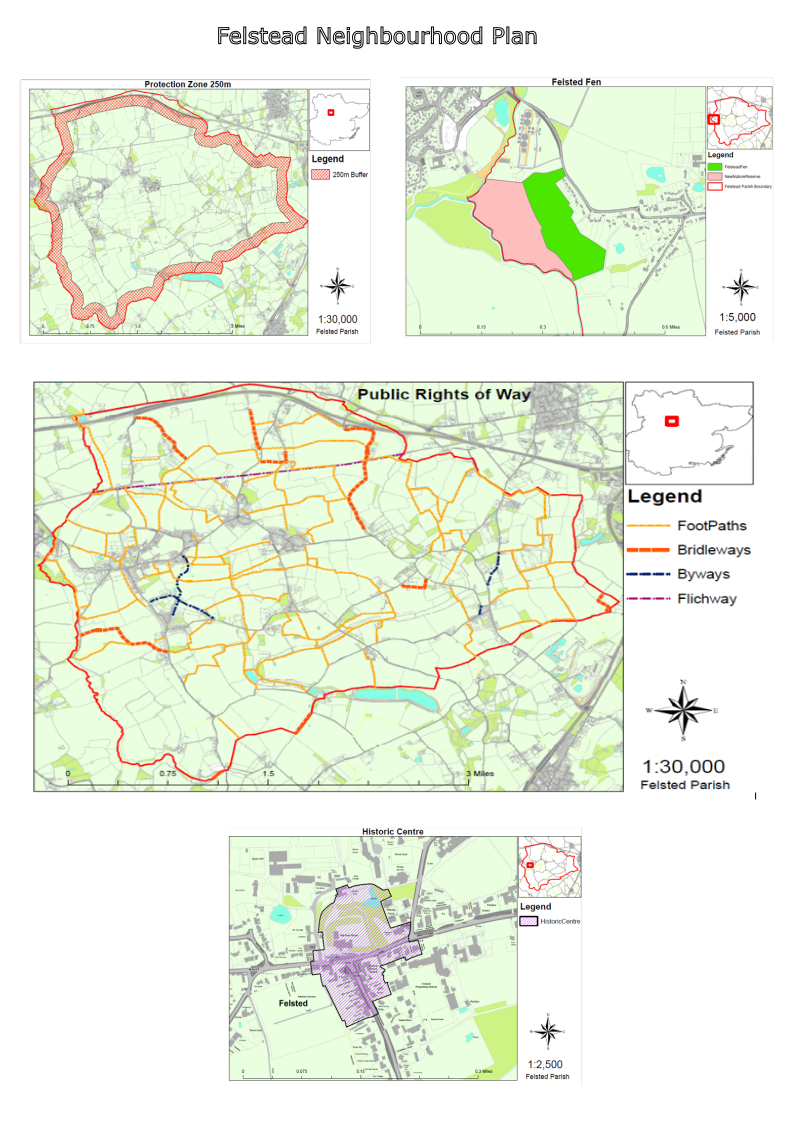
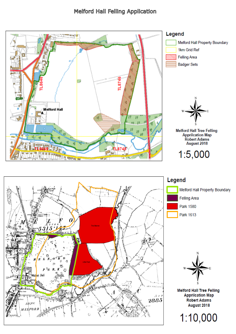
Interactive GIS Mapping uses GeoJSON files to overlay GIS layers on the Webmap allowing project details, hyperlinks and buttons to provide supporting information.
GIS Spatial Mapping was formed in 2014 by Robert Adams. Robert Adams Landscape Architecture is a subtitle that broadly covers the work this company undertakes. Geographical Information Systems (GIS) mapping and database management for analysis, research and visualization of data on map formats.
Historic landscapes conservation, environmental research and Web Development (Webmaps). GIS are the main toolset used for research and development projects.
We offer Consultancy in Landscape Management and Historic Landscape Research (Training on Qgis may also be offered).